NEWS
The latest information on Bali and Balia Garden Villa
THE 7 BEST HIKES IN BALI

Photo of the rice fields of North Bali | August 30, 2022
With such a variety of landscapes, from iconic rice paddies and unspoiled rainforest to plantations and villages, Bali is a walker's dream. This relatively compact and densely populated island is not suited for epic multi-day hikes, but the range of day hikes and weekend hikes will certainly keep you on your toes. In West Bali National Park and on the more difficult peaks and volcanoes you will need a guide, but in most cases you can access and explore even the most remote areas on your own means. Outside of the "Wild West" interior, most of Bali is fairly well populated with villaThey are invariably welcoming and hospitable, so finding supplies is rarely a problem.
MOUNT BATUR
Mount Batur is Bali's most popular trek - and for good reason. You will understand the attraction when you find yourself among 100 other breathless people watching the sunrise view from the 1717m (5630ft) summit across the caldera lake and past Mount Agung, the highest summit of the island, to Mount Rinjani on distant Lombok.
If you start the hike around 3am you should be at the top by sunrise. Most visitors arrange this as a tour of Ubud for easy access despite the early departure (usually between 1am and 2am depending on your accommodation location), and competition between tour operators keeps prices affordable. Balinese Sunrise Trekking and Tour and Indoglobal Adventure are reliable and well-established operators that run daily treks to Batur. Mason Adventures even offers the chance to take in the views of Batur from a helicopter.
It is possible to do this trek on your own (hard to get lost, after all), but before you decide to skimp on the expense, remember that earnings are crucial income for guides in rural communities. Tours are usually over by 9am and you will definitely crave a hearty and healthy breakfast in Bali. Take water and an extra layer - this will probably be the coolest place you'll see in Bali!
BALI NATIONAL PARK
This wild area in the far west of Bali is likely to make you rethink everything you've ever heard about "overcrowded" and "overdeveloped" Bali. At Taman Nasional Bali Barat (West Bali National Park), you can plan anything from a two-hour walk to a full jungle expedition in a wilderness that was once home to tigers (and tigers). rumors about them still abound).
On the Prapat Agung peninsula, you will likely outnumber herds of Sunda deer, as well as common macaques and the rare ebony-leaf monkey. There is relatively little risk of getting lost on the Prapat Agung peninsula (the most popular part of the park), but you need a permit and a guide to access the trails in the western national park from Bali. The most convenient park office, right at the park entrance on Prapat Agung, is near a village called Sumber Kelompok, north of Gilimanuk. Arrive the afternoon before to make arrangements so you can set off at first light the next morning to take advantage of cooler conditions and more visible wildlife. Guide fees vary (sometimes wildly) and you should expect to haggle. A good guide can help you spot giant squirrels (larger than house cats), giant monitor lizards, and many of Bali's approximately 280 bird species.
In the park (as well as the more difficult peaks and volcanoes), an experienced and knowledgeable guide is not only a worthwhile investment in terms of safety, but can also often turn a simple hike into a truly unforgettable experience.
SEKUMPUL WATERFALL
The spectacular Sekumpul Waterfall is just far enough off the beaten track to dodge the high visitor numbers of more accessible sites, such as Gitgit Waterfall, Banyumala Waterfalls and Jembong Waterfall. Dropping a total of about 80m (262ft) into the fern-surrounded pool, Sekumpul is actually a group of seven falls that converge - the name means "to come together" - at this spot. This experience is less of a hike than the perfect reason for a wonderful refreshing swim in one of Bali's most idyllic beauty spots. Other even lesser-known waterfalls (known as Hidden and Fiji Falls) are near the Sekumpul trail.
You will find a ticket office in the car park where you can pay the entrance fee. A three-tier pricing structure is in place. There is an entrance fee of IDR 20 per person (about US$000), which allows you "view-only" access to view the Sekumpul waterfall from a distance. “Medium Hike” access for US$1,40 gets you a guide and offers a donation to the villalocal age and the opportunity to swim at the base of the falls, as well as entry to the hidden falls nearby. The “Long Trekking” ticket (US$14) is essentially the same, plus it also gives access to Fiji Falls, although it is less spectacular than the other waterfalls.
THE SUMMIT OF BATUKARU
At 2276m (7467ft), Batukaru is Bali's second highest peak, but one of the least trodden mountains on the island. Two paths lead to the top, but neither sees a lot of footsteps, and both can become overgrown during the rainy season (October to February). Most hikers start from Pura Luhur Batukaru on the southern flank, but the northwest trailhead at Pura Malen, located around 1000m above sea level, is even more isolated.
With good physical condition, you can reach the summit in less than four hours, so if you start at dawn you can climb and descend in a single day. But for more adventure, plan to camp at the top. It can get chilly at the top, so take a tent and sleeping bag, and make sure you pack plenty of water as you can't always rely on streams. Batukaru is unspoiled Bali at its best.
MOUNT AGUNG
The summit of Mount Agung - as well as up to 12 km (7,5 miles) of its surroundings - has been off-limits since the 2018 eruption. Mount Agung is currently inaccessible, but may soon reopen to the public. When it does, it's fair to say hikers will once again be lining up to scale what is Indonesia's most iconic volcano. From the top, as you sit above the clouds at 3031 m (9944 ft) above sea level, it's easy to imagine you're on top of the world and (as believed Balinese Hindus) in the realm of the gods. Even during times when the mighty Agung has been relatively "peaceful", it is wise to get up-to-date advice on conditions and hire an experienced and knowledgeable guide. Agung is not for the faint hearted. The climb to the summit normally takes six to seven hours and the descent is significantly faster.
THE TWIN LAKES OF MUNDUK
A beautiful trail connects the two highland lakes of Danau Tamblingan and Danau Buyan through shady highland forest and along pristine lakeside trails. You are unlikely to see other hikers in this rarely visited area, although in recent years the beautiful backdrops with their mirrored peaks have become popular with wedding photographers who are attracted not only by the photogenic scenery but also by the ease of access.
Be sure to allow time to explore several picturesque temples, including the exquisitely small Pura Ulun Danau Tamblingan. Take a sarong to wear to dress properly if a temple is in use. If you have a driver, the walk can be done in one direction only. Parking areas are next to both lakes so you can be picked up at the opposite end.
THE CAMPUHAN PROMENADE
For such a short walk, the Campuhan Ridge Walk is surprisingly diverse, encompassing beautiful rice paddies, fruit trees, jungle valleys, and even a temple (Pura Gunung Lebah). But this hike can get hot as there is little shade at the top of the ridge. Nonetheless, this walk makes for a pleasantly gentle ride which, although labeled a ridge walk, is not too steep for small children.
The route is paved - but not smooth enough to allow wheelchairs or pushchairs - making it accessible even in the rainy season when the terrace and jungle tracks around Ubud are impassable. There are a few pleasant cafes and warungs (local restaurants) at the end of the ridge, so the kids can be energized with the promise of a healthy smoothie at the end. If you are staying in central Ubud, you do not need transportation to get to the trailhead near Campuhan Bridge: it is less than 1 km (0,6 mile) from Ubud Market . Residents of Ubud enjoy this walk, so as a bonus, it's a good chance to meet more of these wonderful Balinese.
Full article: Lonely Planet
North Bali airport project continues
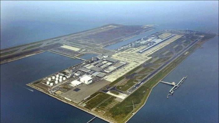
3D Rendering of North Bali International Airport | August 22, 2022
Jakarta - Construction of North Bali International Airport will continue even though it has been removed from the National Strategic Projects (NSP) list. The North Bali Airport is one of eight other projects that have also been dropped from the PSN as some of them were deemed not to be completed until 2024. "That's not to say the project won't be achieved, but the pace will be different. Because there are many problems that require more effort so that in 2024 (it is planned) it will not be finished", said the deputy to the coordination. of regional development and land use planning at the coordination ministry of the economy Wahyu Utomo, city of Antara, Monday (22/8/2022).
This means that the airport construction project in North Bali will continue to operate. Moreover, Bali would need a new airport to complement the Ngurah Rai Airport, located in the south of the island of Bali. The North Bali Airport itself has been included in the Airport Master Plan which has been stipulated in the Decree of the Minister of Transport of the Republic of Indonesia No. 10/166 regarding the National Order Airports. It is known that Ngurah Rai Airport currently has only one runway and cannot be further developed due to ground issues.
Meanwhile, access to commercial flights to and from Bali is only through the one airport. If something happens that causes Ngurah Rai Airport to close, air access to and from Bali is also virtually closed. Since 2016, PT BIBU Panji Sakti has indeed proposed to the government to be the initiator of the construction of North Bali International Airport. The company also conducted studies in eight different locations in Bali to find the ideal place to build an airport. The results of the study indicated that the proposed location with the highest score was on the coast (offshore) of Kubuaddan, Buleleng. This means that the area is ideal for building an international airport from various aspects - social, economic, technical and environmental. Additionally, the results of the PT BIBU study are also in line with Perda No. 18/2009 Regarding North Bali Airport RTRW, which was later updated with Perda no. 3/2020, which determined the designation of the Kubu Supplementary Area as the location of the airport.
Recently, it was heard that the Bali Regional Government was trying to modify the RTRW by moving the location of the airport to West Bali. This is due to land issues which are not correct in North Bali, especially in the mainland of the Kubuaddan district area.
In fact, the airport plan we initiated is to build an airport on the coast of KubuAddan. This means that there will be no land issues that need to be prepared, so we have received a recommendation from the previous governor,” said PT BIBU. President Director Panji Sakti Erwanto Sad Adiatmoko Hariwibowo. In other words, the construction of North Bali International Airport which was initiated by PT BIBU is not proceeding with land acquisition as the airport will be built on the coast of Kubuaddan Beach.
Construction of the airport on the coast will obviously not sacrifice productive lands, occupy community residential lands, displace places of worship (temples) or sacrifice historical sites of Buleleng Regency. It can be predicted that the construction of the airport will not cause social unrest as there are no land acquisition issues. Because according to Erwanto, it is in accordance with the Regulation of the Minister of Transport/PM No. 20/2014 and PM No. 64/2018 regarding the procedures and procedures for determining the locations of airports.
Full articles: finance detik
The development of the Singaraja-Mengwitani expresswaystill ongoing despite the pandemic

3D rendering of the road project | September 3, 2021
The Bali provincial government announced this week that road development for a "shortcut" between Singaraja, Buleleng and Mengwitani, Badung, will continue even during the ongoing pandemic.
“The governor is committed to completing the development of the Singaraja-Mengwitani shortcut even during the pandemic. All infrastructure developments funded from the state budget (APBN) are still going according to plan, nothing has been done. canceled or defeated, "said Nusakti Yasa Weda, who heads the department of public works and land use planning in Bali province.
According to Nusakti, the shortcut will help spread infrastructure development evenly across Bali, including harnessing the tourism potential of northern Bali.
The road megaproject, estimated to cost IDR 471,5 billion (USD 33 million) and funded by the Ministry of Public Works and Housing (PUPR), is expected to reduce the turns and slopes between Denpasar and Singaraja on the existing road, which slowed down cars to speeds of around 20 kilometers per hour in some places along the route.
According to officials, the project also includes the development of several rest areas, including a number of points identified as 7D, 7E, 9 and 10, which will start next year and end in 2023.
However, two more points are planned thereafter, and officials hope that they will be completed in 2024. The previous points of the road project would have completed the development in 2019.